

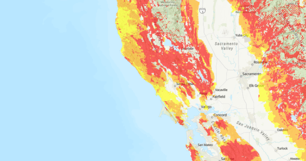
Screenshot of the updated Fire Hazard map (Cal Fire)
Cal Fire is updating its statewide Fire Hazard map for the first time since 2007. Officials will hold 57 public hearings in the coming months to collect more input on the new map. Fire scientists, firefighters, and local community planners have collaborated for years to update and identify potential fire hazards in State Responsibility areas. This covers fire hazard severity zones in the unincorporated counties and rural areas.